


BaseCamp™ Software
Make the most of your next outdoor activity, or relive the trips you’ve taken. BaseCamp lets you plan outdoor activities, organize your data and share your adventures with others.
Take the Tour
Features
Plan a Trip
Use BaseCamp software to plan your next hiking, biking, motorcycling, driving or off-roading trip. You can view maps, plan routes, and mark waypoints and tracks from your computer — then transfer them to your device.
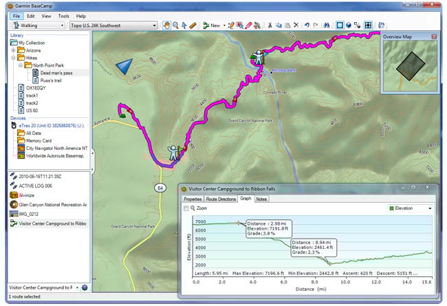
- The Track Draw feature lets you trace your planned route and view elevation changes, helping you estimate the difficulty of a hike or bike ride.
- Plan the perfect scenic route for your next road trip, making sure your navigator takes you through certain waypoints.
- Play back your routes and tracks over time, and save and share your adventure.
Overview
- Import and view maps in 2-D or 3-D, including TOPO and City Navigator® maps.
- Create, edit and organize routes, waypoints and more on your computer.
- View BirdsEye Satellite Imagery, BirdsEye TOPO Raster or BirdsEye Select Raster maps, and transfer the data to your device (subscriptions required).
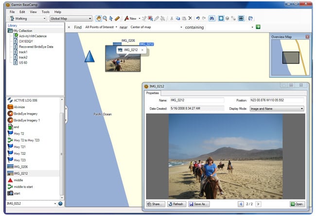
- Create and share geotagged photos.
- View playback of routes, tracks and adventures.
Survey the Terrain
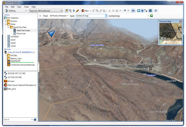
BaseCamp displays your topographic map data in 2-D or 3-D on your computer screen, including contour lines and elevation profiles. Load map data from your handheld device, or import maps you’ve downloaded or purchased on DVD or microSD™ card. Consider our TOPO series maps, which offer detail on a scale of either 1:100,000 or 1:24,000.
Geotag Photos
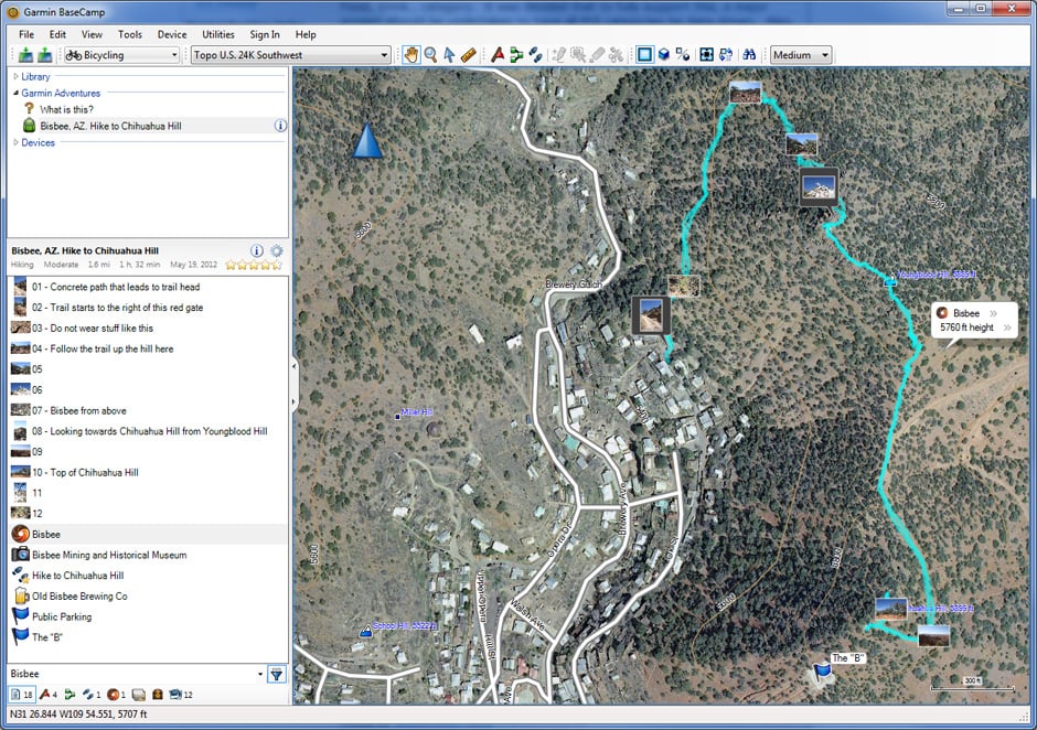
BaseCamp software lets you geotag photos, associating them with specific waypoints. You can see the exact scenery at any given location. Transfer the photos to your handheld device or email your geotagged photos directly to friends or family so they can navigate right to your favorite spots in the future.
Transfer Satellite Images
With BaseCamp and a BirdsEye Satellite Imagery subscription, you can transfer an unlimited amount of satellite images to your outdoor or fitness device and seamlessly integrate those images into your maps to get a true representation of your surroundings. It makes it easy to scout campsites, sources of water, potential hazards and more. If you prefer raster topographic maps, you can also download BirdsEye Select maps and pay only for the data you download.
Download for Free
Windows® Requirements
- IBM-compatible computer running WIN Vista x64 and later. App cannot be installed on Win 7 (no SP) as this is not compatible with .Net framework 4.6
- Microsoft® .NET framework 4.6; a current version of .NET will be installed if needed
- A video card that supports OpenGL version 1.3 or later to view 3-D terrain

Mac® Requirements
- Intel-based Mac running OS 10.13 or higher
- 1024 MB RAM (2048 MB recommended)